Alipurduar derives its name from the late Col, Hedayat Ali Khan who did admirable service in the Bhutan war and was stationed here as first Extra - Assistant Commissioner. After the second Anglo - Bhutan war in 1865, according to the Treaty of Sinchula, the eleven Bengal Dooars were occupied by the British. Colonel Hedayat Ali khan was posted as the Commander at the military settlement on the bank of the river kaljani. The entire tract of land of the Buxa Dooar was leased out to Hedayat Ali on his superannuation and the growing town adjacent to the military settlement began to glow as well.
According to Sailen Debnath, in due course of time the military settlement in the town of Alipurduar turned to be less important because of the rapid growth of military cantonment at Buxa fort in the north of the town and Chila Roy Barrack in Coochbehar. Along with the expansion of the tea plantation and setting up of railway lines, Alipurduar began to be more important in terms of communication and administration.
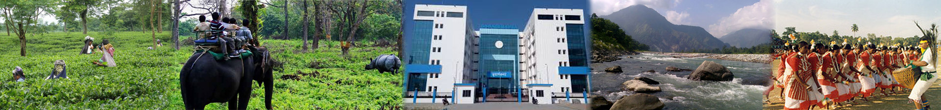
Jalapaiguri district was bifurcated to create Alipurduar District as the 20th district of state West Bengal on June 25,2014.The district headquarters at Alipurduar which is situated on the eastern bank of River Kaljani on the foothills of the Himalayas .The district is the gateway to Bhutan and North Eastern states of lndia. This district is located in the Dooars region renowned for its forest, wildlife, timber,tea and scenic beauty.
Physiography:
Altitude of hilly area ranges from 90m. to 1750m.
Average annual rainfall is about 350 cm. Temperature ranges from 6⁰C - 36⁰C. Monsoon generally starts from the middle of May and continues upto the end of September. The entire area is divided into four main watershed areas by Torsha, Kaljani, Rydak and Sankosh rivers. A large numbers of rivers and rivulets originate from the hilly areas of adjacent Bhutan and carry the excess water of heavy downpour of monsoon to the Bay of Bengal through the Brahmaputra. Heavy downpour occasionally causes flash-flood during monsoon .
A fairly large portion of this District is under forest cover, managed by Cooch Behar Division and Buxa Tiger Reserve. These Moist Mixed Tropical Forests are constituted with 8(eight) distinct types of forests with a rich diversity of Trees (352 species), climbers (100 species), Canes (6 species), Shrubs (133 species), Bamboos (144 species) including rare plants of about 25 varieties. The forests are abode of a spectacular range of faunal variety with mammal (69 species), reptiles (41 species), birds (249 species), amphibian (4 species), fishes (33 species) and entomofauna /insects(353 species).
Culture & Language:
In the later part of 1870's establishment of tea gardens reclaiming the forests and marshy swamps was initiated. There are 62 tea gardens, which add to the scenic beauty of the forest and the Himalayan background. Fairly large portion of population depends on these tea gardens for their livelihood,directly or indirectly. Most of the plantation laborers were migrated from different parts of Chhotonagpur, Westem Odisa, Andhra Pradesh and Madhya pradesh. The plantation labourers usually speak in their own tribal language within the tribe. 'Sadri' a language practiced by their ancestors in Chhotonagpur area is used as link language among the different tribes. Now a day's Hindi is also used for this purpose.
The area is inhabited by tribes and castes like Ravas, Garos, Meches, Totos, Dhimals, Koches,Nepalis and Rajbanshis etc. The exodus of Hindus from the erstwhile East Bengal at the time of partition in 1947 and their settlement in these areas reduced land-man ratio in a great extent. The culture of these migrated Hindu people mingled with rich folk culture of the aboriginals and thereby enriched overall culture of these area. With the advent of time people had come and settled in this area from almost all corners of India. These people speak about 141 languages including some distinct dialect. However, Bengali is commonly spoken language. Intermingling of heterogeneous ethno-cultural groups helped evolve a strong eco friendly material culture in this area since prehistoric period. Admixture of traditional knowledge of different ethnic groups with advanced technology, easy availability of indigenous materials and climatic condition of this area augmented this process to gain a different shape than other parts of Bengal.
EVOLUTION AND CONSTITUTION:
Alipurduar Zilla Parishad was formed on 04.07.2014 as a result of bifurcation of erstwhile Jalpaiguri Zilla Parishad, in terms of Notification No.2926lpN/0/ytp-38/2012 Dated:04.07.2014, Due to District Creation vide Notification No.634-PAR( ARI0/2R-4/ 12 Dated:2l.06.2014 \N .e.f. 25.06.2014.
The election of the Sabhadhipati & Sahakari Sabhadhipati took place on 27.10.2014, election of members of Sthayee Samity took place on 03.11.2014, and that of Karmadakhyas of the Sthayee Samities on 13.11.2014, in terms of Memo No.54lp&RD Dated: 13.11.2014 of the District Magistrate Alipurduar read with Notification No.3875(2),pN tjtV1p-38t2012(pt-tl) Dated:09.09.2014 of the P&RD Department
Shri. Mohan Sharma, member of Kalchini Zp-7 was elected the Sabhadhipati. Shri. Atul Suba member of Kalchini ZP-g was elected the Sahakari Sabhadhipati.


Office of the Zilla Parishad,
Maya Talkies Road, Alipurduar Pin.736121
Alipurduar,
Email :aeoalipurduar@gmail.com
Phone No.03564-257587
Fax.03564-257587